Comment

Balzac on history

Though today is the 4th of July and it would be appropriate, I don't have anything to post about United States history or pyrotechnics (but, luckily, other people do). Instead, I want to share a quote with no relation at all to the 4th of July. Well, it comes from someone who did have a lot to say about the July Revolution of 1830. Does that count? Bear with me here, I'm reaching.Anyway, I'm currently reading (among other things) Collingwood's The Idea of History and Balzac's Béatrix. I mention Collingwood because in this passage, from the first paragraph of Béatrix, Balzac also comments on the philosophy of history:

Whoso would travel as a moral archaeologist, observing men instead of stones, would find images of the time of Louis XV in many a village of Provence, of the time of Louis XIV in the depths of Pitou, and of still more ancient times in the towns of Brittany. Most of these towns have fallen from states of splendor never mentioned by historians, who are always more concerned with facts and dates than with the truer history of manners and customs.
Balzac's nostalgia is evident here, but it's still something to ponder. I'll just let it stand without (further) comment.

Comment

2 Comments

You always have friends in Acre

This AP story promoting travel to Acre got forwarded around various archaeology lists the other day, and it got me thinking about my visit to Acre in 2009.  I was digging at Tell es-Safi at the time (there's a Crusader castle there, too, called Blanche Garde, although the current excavations focus on the earlier periods), and four of us decided to take a trip to see a few sites in northern Israel, including Acre, Caesarea Maritima, and Megiddo.  Acre was definitely a memorable place, and I'd say it's certainly worth a visit if you get a chance.The history of the site is, of course, fascinating.  As the article mentions, it was an important Frankish port up until its destruction in the late 13th century by the Mamluks, as part of a larger campaign wherein they destroyed nearly every Mediterranean port in the Levant (Gaza being the one exception).  Following that (and its abandonment in the 14th century), the city went through some ups and downs in the Late Islamic (Ottoman) period, and there are a few interesting stories there.  Notably, it was briefly a holding of Fakhr ad-Din II, starting in 1610.  Hartal (1997:111) describes that situation like this:

Following Fahr ed-Dîn's conquest of the city in 1610, he cleaned the harbor, renewed maritime trade, enlarged the city, and built some new buildings . . . In 1613, however, when the Ottoman Turks campaigned against him, Fahr ed-Dîn ordered the harbor to be filled in and had the city devastated.
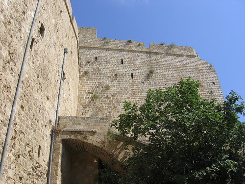
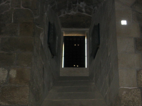
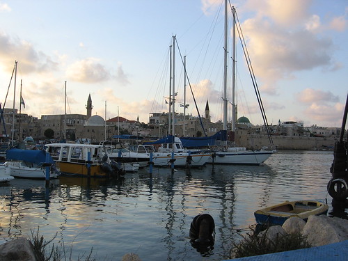
I've always found this to be an amusing story, in a way.  In 1610, he cleans the harbor and expands the city, and three years later fills the harbor in and destroys part of the city.  There's also the story, mentioned in the AP article, of Napoleon's failed attempt to take the city in 1799, when it was controlled by Jazzar Pasha.  Al-Jazzar (الجزار), incidentally, is not a very nice nickname; it means "the butcher."  After Napoleon's unsuccessful siege, Jazzar Pasha understandably decided to fortify the city, using stone taken from the Crusader city as well as 'Atlit castle (Hartal 1997:112; generally, Hartal [1997] has a good, brief discussion of the post-Crusader architectural history of the city).Reading the story, though, I decided to go back and look at the photos I'd taken while I was there.  Of course, I got some nice, scenic shots of the city, like this one:Acre HarborLike most of coastal Israel, it really is a beautiful place.  I definitely wouldn't mind spending more time there.I also took quite a few photos of buildings in the Crusader city, like this one:AcreThis isn't the most interesting photo I've ever taken, but if you look at it closely you get some hints at the construction phases of the building.Then there's this one, taken in the refectory (dining hall) of the Hospitaller fortress in the old city:Acre, Crusader refectoryOh, hello there. . . didn't see you guys up there before.
1997     Hartal, MosheExcavation of the Courthouse Site at 'Akko: Summary and Historical Discussion. 'Atiqot 31:109-114.

2 Comments

Comment

And trying to meet halfway

I started this post in February, and didn't quite know how to finish it, so it sat here for months waiting for me.  I didn't want to post anything else until it was finished, and so I've decided to finally just finish it quickly (and not entirely satisfactorily) and put it up.YouTube can be a funny thing. Its suggestions are often really far off, but sometimes you wind up with something that's not really related to what you were looking for, but completely fascinating. Today Months ago, I came across this video in the sidebar to another video I was watching:http://www.youtube.com/watch?v=Lq0dG0h8TokIf you aren't familiar with Centralia, PA, it's a fairly recent ghost town, abandoned as the result of a coal seam fire that's been burning for the past 50 or so years. These are actually not as uncommon as you might think – the more notable examples include the Brennender Berg in Saarland, which has been burning since the mid-17th century, and Burning Mountain in New South Wales, which has been burning since the 4th millennium BC (there's also the well-known and striking Darvaza, in Turkmenistan, which wasn't a coal seam fire, but a long-lasting natural gas fire). And there are, of course, others.This video is rather interesting for a few reasons. First, most of the stuff you see in Centralia is no longer around. All of the buildings were condemned in 1992, and as a quick scan of Google Earth will tell you, most of them have been bulldozed. I was thinking this might be an interesting use of Google Earth's historic imagery feature, but unfortunately this only goes back to 1993 for the area, so you don't see a whole lot of change.  Of course, YouTube is facing no shortage of videos of what Centralia looks like now to juxtapose with this one.  Many of them compare Centralia to Silent Hill, but I've watched a few of them and no one seems to have caught the monsters on film, so I'm not sure this is the most apt comparison.  You can also get a glimpse of Centralia in 1986 in the beginning of Made in U.S.A. (soundtrack by Sonic Youth!), which is, as I update this in June, currently streaming on Netflix.But then there's an odd combination of a few other things. The mundanity of the video itself is almost striking, given what would eventually become of the city. It's a great example of an unintentional historical document: a record of a family trip (I assume) can become a record of a place that they simply passed through. The video is called "A Trip to Centralia, Pa Circa 1957," but the main event here actually seems to have been the Bloomsburg Fair. At roughly 2:03 or 2:04 there's a brief and ominous glimpse of the mining operation itself, but it only lasts a few seconds.  These things stand out now, but the video itself almost forces you to realize that nothing seemed out of the ordinary in the late '50s.I'm also reminded of this story I read in Wired (now more than) a few months ago about Picher, OK, another recent industrial ghost town, although abandoned for different reasons.  In that case, toxic mining waste made the town uninhabitable, and yet a few people continue to live there, which was the point of the Wired story.  In both cases, it's this emotional attachment to a place that interests me most.  The circumstances were, of course, much different, but it makes me wonder about the ancient miners and smelters in southern Jordan, and what they felt when those sites were abandoned.

Comment

Comment

Sharing data on the web

As I was doing some reading for a project I'm working on, I happened to come across a decade-and-a-half old Antiquity review of a few survey volumes, mostly dealing with the Mediterranean world (Alcock and Cherry 1996). One of the last points Alcock and Cherry tackle is the dissemination of data – specifically, rather large sets of artifact data – from surveys. A lot of ELRAP team members have recently been involved in discussions of how to do just that, and it's instructive to look back and see what's changed in the past 15 years. They present these options: publish the artifact data as a separate hardcover volume; include the artifact data with the survey volume on microfiche (I'm so glad this never really caught on); publish the artifact data in a separate, but inexpensive, paperback volume; publish the data on a CD-ROM included with the survey volume; or publish the data on the web (Alcock and Cherry 1996:211).Again, it's worth keeping in mind that this review is rather old. Perhaps my perspective is skewed by my age of scarcely more than a quarter of a century and, worse, my academic focus in the first half of the second millennium AD (practically yesterday by archaeological standards), but I think it's important to consider just how long ago this really was in terms of technology. This Wikipedia illustration demonstrates what I'm getting at rather nicely. At the time the review was written, web browsers had only been available to the public for five years, and it had only been three years since the release of a web browser anyone actually used (I'm thinking of Mosaic). Internet Explorer was less than a year old. Surely, in the fifteen years since, web publication has become the obvious choice, even if it wasn't then.Yet, this isn't really the case. To single out one example, only three years ago the Wadi Faynan Landscape Survey publication was released, which included a CD-ROM with supplementary data (Barker et al. 2007). I'm not saying this approach is necessarily bad (though one might object to their decision to include the site gazetteer as a 530 MB PDF), but it still seems strange that web publishing isn't the obvious choice for this sort of data. I can understand the appeal of media – like CD-ROM or, heaven forbid, microfiche – that are directly associated with the survey publication, and I appreciate when artifact data are made available in any form, but I still think web publishing is preferable, not least because it opens up our results to people who are neither associated with large institutional libraries nor able to justify the cost of a large survey volume or subscriptions to all the journals in which preliminary reports may have appeared.  (Of course, that's another argument in favor of so-called "Green Open Access", or self-archiving and sharing of publications in non-open journals and books.  ELRAP actually does a fairly good job of this; you can download many, though not all, of the recent publications from our lab here.)Alcock and Cherry (1996) mention the Pylos Regional Archaeological Project as an example of a project that was already moving in this direction in 1996. It's still, despite a few flaws, a good example of what data sharing on the web should look like.  In part, though, this may be because there don't seem to be that many other examples, or at least examples that I'm aware of, of other projects that share this much data online.  ELRAP is, of course, just as guilty of this as any other project, although we're at least currently discussing ways to make our data available to others.  Still, it's a bit more complicated than just saying, "OK, I agree to share.  Put it all up on the web."  I can understand why there would be projects whose members just don't want to deal with it.  All things considered, I wonder how close we are to this type of data sharing becoming the norm.  It's only been 15 years. . .

1996     Alcock, Susan, and John CherrySurvey at any price? Antiquity 70(267):207-211.
2007     Barker, Graeme, David Gilberston, and David MattinglyArchaeology and Desertification: The Wadi Faynan Landscape Survey, Southern Jordan. Oxford: Oxbow.

Comment

1 Comment

I'm finally a real academic

No, the title of this post doesn't refer to the fact that I finally displayed a poster at this year's ASOR Annual Meeting, although that would be a good guess.  Rather, it's about an e-mail I received last night from an Acquisition Editor at VDM Publishing House Ltd. offering to publish my M.A. thesis.  And no, I am not thrilled at the prospect of publishing my thesis with them – in fact, I sent a short but (in my opinion) polite e-mail declining the offer. I'm quite pleased, though, that I've now made enough of a dent in the academic world that at least those people who spend a lot of time trawling through recently submitted theses can find my work.I had, of course, heard of VDM before last night, thanks mostly to this entry on Michael E. Smith's blog and this one on Writer Beware, which he links to. If I hadn't, though, I'd like to think a quick Googling would have made me a bit suspicious, as the first three auto-completions Google suggests for "vdm publishing" are "vdm publishing house," "vdm publishing house ltd" and "vdm publishing house ltd scam." That doesn't really inspire much confidence. I'm not sure what exactly to call their methods, as they object to people calling them a "vanity press" or referring to their "cold-call" e-mails as "spam" ("No sir. Our model is the trapezoid!"), but it doesn't much matter, and the previously-linked blogs discuss these points in a lot more detail than I'd like to.I'm still a bit confused by one line of defense offered by commenters on some of those blog posts, though.  What everyone seems to agree on is that if you can publish your work somewhere else, you should.  In terms of my thesis, rather than publish those 70 pages as they are, it made more sense to distill them down and work on turning the most interesting parts into a better-written and better-edited paper, which is what I chose to do.  The defense goes, though, that it's better to publish with a press like this than to simply leave your thesis or dissertation unpublished, and I don't think I buy that.  Leaving other issues – for example, the merit of having two CV/resume entries for exactly the same work – aside, it doesn't seem to me that this is actually very different from not publishing your thesis, since people who have published with them almost universally comment on the fact that their work was accepted as-is with no further editing.  So, for American theses/dissertations, at least, what's the difference?  Skimming through the VDM publications on Amazon, it looks like their prices are roughly $65-$75 for about 70-100 pages of book.  ProQuest/UMI, on the other hand, tells me that I can get a paper copy of my thesis for between $45 and $75, depending on whether and how I want it bound.  Or, if anyone really wanted to read it, they could just e-mail me and ask for a PDF (or, in this specific case, wait for us to publish the paper).  The only real difference is that VDM books are listed on Amazon.  I guess that's a selling point?And now, I wait to see whether anyone can find my blog on Google. The measure of that, of course, is whether I get the VDM copied-and-pasted response in the comments.

1 Comment

Comment

Looting and Google Earth

It's been a few days since I started and forgot about this post, so this is somewhat old news, but I'm posting it anyway.I didn't notice when it went up a few days ago, but Heather Pringle has a news story in Science (via) which includes a bit about using Google Earth to map looting activities in Jordan (the parts about mapping Guantanamo Bay are also a good read, of course).I thought this all sounded very familiar, and sure enough, I've had the paper from the Journal of Field Archaeology that she cites (Contreras and Brodie 2010) in my Papers library for a few months now, but hadn't gotten around to reading it. So I read it, and actually it's pretty neat. The authors used data from the DAAHL to identify cemetery sites, and then monitored looting activities using the "Historical Imagery" feature in Google Earth. The idea of using time-series imagery to monitor looting isn't really new in itself, of course. Politis (2002) discussed much the same thing, but using aerial photographs instead, at Ghor as-Safi. Google Earth makes this relatively easy, though, especially because the historical imagery is already there. This is a type of project that's been on my mind recently, so it's nice to see that there's some interest in doing this sort of work.References:

2010     Contreras, Daniel A., and Neil BrodieThe Utility of Publicly-Available Satellite Imagery for Investigating Looting ofArchaeological Sites in Jordan. Journal of Field Archaeology 35(1):101-114.
2002     Politis, Konstantinos D.Dealing with the dealers and tomb robbers: the realities of the archaeologyof the Ghor es-Safi in Jordan. In Illicit Antiquities: The theft of culture and theextinction of archaeology. N. Brodie and K.W. Tubb, eds. Pp. 257-267. NewYork: Routledge.
2010     Pringle, HeatherGoogle Earth Shows Clandestine Worlds. Science 329(5995):1008-1009.DOI: 10.1126/science.329.5995.1008

Comment

Comment

Pleasure reading

In between the work I've been doing, I've also had some time to read a few things for my own amusement, and recently finished Jerome K. Jerome's Three Men on the Bummel, the equally-amusing-but-still-not-quite-as-good follow up to Three Men in a Boat (To Say Nothing of the Dog), from which the title of this blog is taken. In both books, Jerome often discusses the history of the places they visit, and many of these descriptions are pretty funny. Given my own work, I found this line in his description of Breisach especially good:

But when one begins to think of these things one finds oneself wondering why anybody in the Middle Ages, except kings and tax collectors, ever took the trouble to live at all

Comment

Comment

But is it art?

The Peabody Museum at Harvard has what looks like a pretty cool exhibit running now, called "Spying on the Past: Declassified Satellite Images and Archaeology". Looking only at the Peabody page, the name might seem a bit odd, given that, of the six images they show, at least four are not from spy satellites — nor, to my knowledge, were images from those satellites ever classified to begin with — and one is not from a satellite at all. There's a Boston Globe article from a few days ago that discusses the exhibit, though, and it seems like the focus is heavily on the declassified CORONA imagery. It's an interesting concept for an exhibit, and if I'm in Boston before the exhibit closes (which is a lot less likely than it would have been last year) I'll probably stop by to see it.The line about "modern technology" and its "up-to-the-minute dynamic" in the Globe article struck me as rather funny, though. Those CORONA images are 40 years old now — more than that, even, in some cases.  More importantly, though, the appeal of CORONA imagery for archaeology isn't its up-to-the-minute technology, but almost the opposite: they give us a relatively low-cost, relatively high-resolution view of what these areas looked like 40 years ago.  Although I guess it's still pretty "up-to-the-minute" compared to Tell Brak.

Comment

1 Comment

Extreme experimental archaeology

I hadn't heard about the project at Guédelon until today, when I came across this BBC story. Apparently the construction has been going on for over a decade, which I think disqualifies this story as "news" in the traditional sense of the word, but it's still news to me.It's definitely an ambitious project, which I suppose you'd expect given that they're building an entire medieval castle.  They're not scheduled to complete the castle until 2023, or more than 25 years after the beginning of construction.You can see a rather striking contrast if you look for the castle in Google Earth (you can see it in Google Maps here, but if you look at it in Google Earth you also get some nice pictures people have uploaded).  If you zoom in on the castle, and then move to the southwest, there's a parking lot about as big as the actual castle site.  I suppose that's one thing that separates this from a real 13th century castle.

1 Comment

Comment

LiDAR in Belize

There's an interesting open-access feature in the latest issue of Archaeology — which also has a nice shot of a tomb at Madain Salih on the cover — about using aerial LiDAR to map features hidden under jungle canopy around Caracol in Belize. ("That's great," I hear you say, "but is there anything in there about the Donner Party's dog?" I'm glad you asked, because yes, there's this.) This story isn't really new — it's appeared in several other places recently — but I read about it then, forgot about it, and then read this as I was glancing at the Archaeology site a few days ago, and thought I'd mention it here.The interesting thing about this for me is that, when I was first told about it by one of the undergraduates (now a former undergraduate) working in our lab, it seemed impossible. The active sensors that tend to be good at "seeing through" things like leaves (or sand) are in the low-frequency, large wavelength part of the spectrum, like L-band SAR (Synthetic Aperture Radar), which has been used to do exactly that. Visible light, on the other hand, is much higher-frequency, and not so good at penetrating dense tree cover. From a common-sense perspective, this shouldn't be terribly surprising; it's darker under dense canopy than it would be if you were standing on top of the trees, because visible light doesn't make it through. So, it seems like what you would get if you took scans of an area of dense canopy would be a very nice image of all of those trees. And this is, in fact, exactly what you get (see the "b" view of this National Geographic image, for example).But somehow they did actually manage to map what was under there, and I think the way it works is pretty neat. As the authors put it:

Initially, the lasers are refracted by the tops of trees, producing a detailed record of the forest cover. But treetops are porous, so some photons penetrate deeper, while others reach all the way to the ground and reflect back from the underlying surface terrain—and any buildings or ancient structures on it. The result is an accurate, three-dimensional map of both the forest canopy and the ground elevation beneath it.
This was my guess as to the only way it could work when I heard about the story last month, and as it turns out, that is the way it works. Again, it makes sense from the common-sense perspective. The only way that an active sensor in the visible spectrum could penetrate forest cover is the same way that light normally penetrates forest cover: through all the little breaks between leaves. After a quick Googling, I fount out that this isn't an entirely new idea, either, although it was the first I've heard about anyone using LiDAR this way. Its application to archaeological survey still seems rather novel, though, and productive for areas where pedestrian survey is made difficult by forest density. And it's always nice to see aerial remote sensing being used successfully to make accurate archaeological maps.References:
2010      Chase, Arlen F., Diane Z. Chase, and John F. WeishampelLasers in the Jungle. Archaeology 63(4). http://www.archaeology.org/1007/etc/caracol.html.

Comment

Comment

Another lost city found

There's an interesting, albeit quite short, article in the current issue of Science entitled The Map of Altinum, Ancestor of Venice by Andrea Ninfo et al. If you can't access the full text version, you might want to look at the ScienceNOW article -- which is, incidentally, at least as long as the actual article -- to see their figures. As they note, there are no ruins of Altinum; all of that has been robbed out or lost naturally over the years. Their map of the city, then, is based entirely on cropmarks observed in multispectral aerial photographs, and their results are fairly striking.What makes those results striking isn't the spatial resolution of the imagery -- 50 cm multispectral satellite imagery isn't available, but there are several commercial satellites with that kind of resolution in the panchromatic band; even in 2007, when the authors' imagery was obtained, QuickBird approached this kind of resolution -- but the fact that the authors were able to obtain imagery of the area under ideal circumstances. This isn't exactly a new insight -- archaeologists since O.G.S. Crawford have pointed out that the conditions under which aerial photographs are taken can have profound effects on what is visible in the images -- but it's still good to keep in mind. In one sense, this is a good argument for using aerial photography, since it's fairly easy to control when the photographs are taken, but there's also a good argument for satellite imagery in here. If you happened to know that the crops in this area were particularly stressed in July 2007, but didn't manage to get a plane up to take pictures for you, it wouldn't be particularly difficult to find satellite imagery from July 2007.This type of study isn't new, but they've done a really thorough job so far of creating the map of the city. As I mentioned, it's a very short article, but I'm definitely curious to see what will come of this, and how they'll integrate the work they've done so far with the excavations that are presumably to come.References:

2009   Ninfo, Andrea, Alessandro Fontana, Paolo Mozzi, and Francesco Ferrarese.The Map of Altinum, Ancestor of Venice. Science 325(5940):577.DOI: 10.1126/science.1174206

Comment